Klapatche Park, 07/24/10-07/25/10

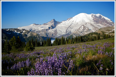
When I first flipped through my copy of 50 Hikes in Mount Rainier National Park and saw Ira Spring’s photograph of Klapatche Park, the destination shot to the top of my to-hike list. And like most locations on my to-hike list, it just stayed there. I was reminded of it again last year, while watching The National Parks: America’s Best Idea, which briefly flashed another Ira Spring photograph of the same location, this one from many years earlier.

The problem is, Klapatche Park isn’t all that easy to get to. In the not-too-distant past, one could park their car within three miles of it, but the road washed out twenty-one years ago and left the western side of The Mountain more isolated than most of the rest.

After walking the more recently decommissioned Carbon River Road earlier this year, I decided that it was time to walk the Westside Road and visit the fabled Klapatche. The weekend’s weather would be perfect, and from what I’d read on the Mt. Rainier National Park website, snow levels seemed pretty favorable, too.

This trip would be solo.

Read more of this post

Carbon River Road and Glacier, 06/12/10-06/13/10

After spending Friday evening celebrating an improbable new job for me, we woke up Saturday morning eager to take advantage of beautiful weather but somewhat unprepared to do so. I’d been thinking about heading to the Carbon River entrance of Mount Rainier National Park, and its nearby location and easy walking made it seem like a good candidate for our first backpack of the year.

The Carbon River washed out the road of the same name some years back, and it stranded what used to be a drive-in campground some five miles down a now-but-perhaps-only-temporarily-decommissioned road. I thought we’d walk the five miles to the campground, set up our tents, and head off and explore the area, perhaps continuing on to Carbon Glacier, the lowest-elevation glacier in the Lower 48.

Nicole on the Carbon River Road.

Even though we didn’t get a super early start, the northwest corner of Mount Rainier National Park is such a quick drive that we’d gotten to the park, stopped in at the ranger station for our permit, and started off down the road by 11:15.

Read more of this post

Paradise Snowshoe, 02/06/10

Sheer and utter laziness has kept me from putting up this short and sweet trip report until now, but with other reports forthcoming, I decided it was now or never.  And never was not acceptable.

A most excellent coworker of mine had offered to lend me and Nicole snowshoes at any time, and once the weather forecast looked good, I called in the favor.  We’d never been snowshoeing before, but had wanted to forever.  Winter has traditionally been a time of near-hibernation for us.  And while we’ll definitely not be giving up all winter weekends of food and football, mixing in some outdoor activity is something we should do with more regularity.

So it was, a beautiful Saturday morning, snowshoes in hand, that we set off for Mt. Rainier.  Snow levels are low this year, so we went high, where we knew we’d find some: Paradise.  It seemed like the perfect place to try snowshoeing for the first time.  Plenty of snow, easy to get to, plenty of short easy-to-follow trails to choose from, and, of course, The Mountain.

We made our way from Seattle to the Paradise parking lot, put on our brand-new gaiters and other layers, walked off the asphalt parking lot, and stepped into our snowshoes.  For the next two hours, we meandered around Paradise, following short trails just above the parking lot, making loops, and heading down portions of closed roads that, during winter, make fine cross-country ski and snowshoe trails.  The weather was perfect.

Nicole on the snow slopes of Paradise.

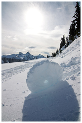
A snow wheel.

Sun on snow wheel.

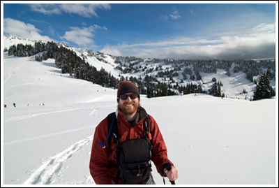
Jeremy in Paradise.

Jeremy in Paradise.

Afterward, we went in the visitor center, warmed up, and ate our lunches.

It was a great morning, and a great way to get out into the snow for the first time.  We intend to do it again, and may buy our own snowshoes for next year.

No stats—maybe two miles.

But, as always, a few more photos at Flickr.

The Burroughs, 07/19/09

After “losing” the first weekend in July to my grandmother’s 80th birthday party and the second to a Saturday spent soaking at Breitenbush Hot Springs, we were well overdue for a hike. Sunday was the only day available to us, so we settled on a dayhike at Mt. Rainier National Park.  I’d seen some stunning photographs taken from the Burroughs trail near Sunrise, and yearned for some in-your-face views of The Mountain—on prior trips to Mt. Rainier National Park (Spray Park, Summerland) the eponymous mountain remained frustratingly hidden in cloudcover.  If the weather forecast was to be believed, this day would be different.  It was.

Mt. Rainier and wildflowers from just above Sunrise.

Mt. Rainier and wildflowers from just above Sunrise.

On top of our hike starting at the always-busy Sunrise Visitor Center, we learned during the week that it was Get Into Your National Park Free Day, or some such thing.  So I set my alarm early, had no trouble getting Nicole out of bed, and we were on the road at 04:40.  I love early starts, but even as we cruised through Enumclaw and the tip of The Mountain lit up, I wished we’d started even earlier.  At 06:40, just two hours later, we pulled into Sunrise with our pick of the parking lot.  Ten minutes later, we were on wide empty trails through lupine with outstanding views of Mt. Rainier.  Of course, the views of Mt. Rainier are outstanding from the parking lot.

hikers_50

Read more of this post

Navaho Peak, 06/28/09

Somehow, Nicole and I had yet to truly reach a summit. It’s probably because we’d never picked a hike with the summit of a mountain as our destination. On Mt. Aix, we came close, only to be turned back by fear and thunderclouds. At Marmot Pass earlier this year, summiting Buckhorn Mtn. had been a thought until full backpacks and bum knees made us think otherwise. So reaching a summit was overdue, and Nicole in particular really wanted to accomplish that goal.

Mt. Stuart and The Enchantments Range from Navaho Peak.

Mt. Stuart and The Enchantments Range from Navaho Peak.

Cousin Bobby, who accompanied us on our hike to Goat Lake two weekends ago and didn’t break a sweat the entire time, wanted to go out again. We wanted to take him somewhere impressive, as we only have a few more free weekends until his internship ends. We also wanted to make him sweat.

Our friend David, who just returned from teaching English in Mexico for ~1.75 years and is staying with us at the moment, insisted that he had boundless energy and didn’t want to be left behind. He may have been exaggerating, and he might be regretting his decision at this very moment.

Our destination was chosen earlier in the week: Navaho Peak, in the Teanaway area. Like last week, we were unpleasantly surprised to find that Navaho Pass was declared WTA’s Hike of the Week. Undeterred by this obvious and repetitive display of telepathic plagiarism, we kept the plans in place as they were.

hikers_50

Read more of this post