Kalalau Trail, Kauai, 03/13/2013

Hawaii. Islands of my pre-adolescent dreams. After living in Seattle for 10 years, we were lucky enough to be able to go for the first time last February. Adelaide hadn’t yet turned one. And the spoiled little brat got to go back just after turning two. Seriously, it took us thirty-some-odd years to get to Hawaii for the first time, and she’s been there once for every year she’s been on the planet. At least this time her demeanor and behavior had improved to the point where we did a bit more than we could’ve the first time.

The biggest thing on my list was to hike at least a bit of the Kalalau Trail on the Nā Pali Coast. We’d glanced longingly at the trailhead on our first visit to Hawaii, but were content to enjoy Ke’e Beach that time—probably our favorite beach ever so far. Even with a so-so forecast this year, we drove from Poipu to the end of the road (Kuhio Highway 560) and tried our luck.

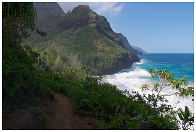
And we were lucky; the weather was better than we’d hoped for. Helicopter tours continually buzzed overhead. Constantly we soaked in views of the coast ahead and the colorful ocean below. Yes, there were a lot of people. Yes, I wore terrible shoes which blistered my ankles to the point that I have minor scarring. Yes it was only four miles total (two in, two out).

It’s worth it.

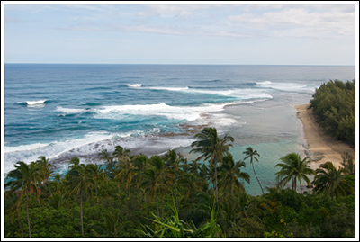
Ke’e beach from above, near the start of the trail.

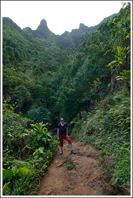
Nicole with valley walls looming above.

Nicole with valley walls looming above.

That's the ticket.

That’s the ticket.

Writing this post has reminded me that I actually did get out on a hike the first time we were in Hawaii. I went with my friend, Casey. I’ll have to write that up, too. (It’s a bit off of the beaten path and takes you out along one of the ridges of the Nā Pali.

The next time we’re back in Hawaii we may try a different island. But Kauai will always be our first. We’ll return, and we’ll backpack this trail, too. I need to camp on the beach here.

Stats: it’s not easy, but it’s not terribly difficult. Don’t drown or fall of cliffs. This is a famous trail so I’m sure you can get more details elsewhere. The Ultimate Kauai Guidebook is a must if you’re planning a trip to the island, whether hiking or not.

Short Trips in Sisters, Oregon, 07/03/10-07/04/10

Some good friends invited us to spend the extended Fourth of July weekend with them and friends of theirs at a ranch in Sisters, Oregon. We enthusiastically agreed, and had a great time. The area is beautiful—the closest we’d ever been is the also-beautiful Breitenbush Hot Springs, but the environment is a little different on the east side of the mountains.

Three Sisters from The Ranch.

There were wonderful views of a lot of volcanoes and near-perfect weather…

Read more of this post

Zion National Park, 05/28/10-05/31/10

A few months back, Nicole’s dad (a.k.a. Jim) said he wanted to meet up with us and his son (a.k.a. Miles) over Memorial Day weekend and do some backpacking or hiking. He suggested Yosemite, but snow levels and full campgrounds sent us searching for alternatives. I researched other areas in California, where Nicole’s dad and brother both live, but eventually put forth the option of Zion National Park in Utah—if they didn’t mind flying.

Zion sandstone in black and white.

Jim enthusiastically agreed and we quickly purchased airline tickets, booked a hotel room, and reserved a rental car. Prices and flight times conspired to send us into Salt Lake City (a 5-hour-from-Zion drive) instead of Las Vegas (a 3-hour-from-Zion drive). We’d leave Seattle Thursday night and return Monday evening…

Read more of this post

Cathedral Rock, Sedona, Arizona, 01/02/10

We started The New Year off by flying down to Arizona to meet Nicole’s dad and brother and go to a football game.  Since we had a little spare time, the three of us—brother excluded, as he was arriving later—drove up to Sedona for a day to sample the Red Rock Country.

The drive up to Sedona from Phoenix went quicker than expected; before long we’d picked up our $5 Red Rock Pass and a map and were parked below Cathedral Rock.  We hadn’t quite made it before sunrise, but the weather was pleasant and the skies were blue.

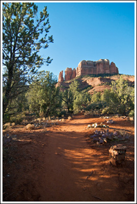
Cathedral Rock, trail.

Cathedral Rock, from near the trailhead.

The trail itself is short and—aside from the beginnings pictured above—steep.  Let’s call it 1.4 miles round-trip with a gain of about 600′, all on the way up, of course.  It’s actually somewhat scramble-y, requiring the use of hands several times.

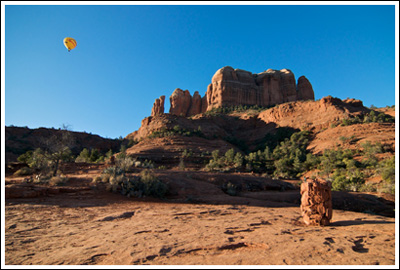
Cathedral Rock, with balloon.

Balloon, rock, cairn.

A pair of hot air balloons floated above us, drifting leisurely but audibly between the sheer walls and spires that the trail would take us to.

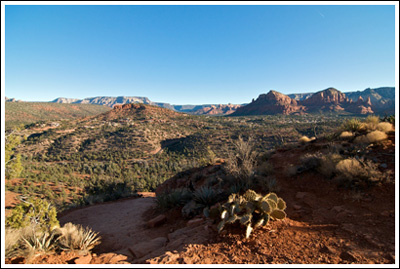
Towards Sedona.

The view north, toward Sedona.

Views were excellent, coyotes were crying, and the sun shone in our eyes until we found ourselves in the shade of the rock itself.  It was a quick climb, but quite rewarding.  We reached the top, sat within the supposed energy vortex—though the cold I’d been battling did briefly relent—and enjoyed the morning.

End of the trail.

Within the vortex.

Before too long, we were back at the car, where other cars awaited our soon-to-be-vacated parking spot.  We saw only a few people on our way up, quite a few more on our way down, and missed the inevitable hundreds that were to come.  I recommend an early start!

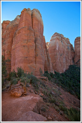
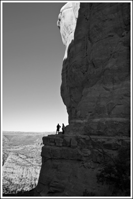
HIkers on Cathedral's ledge.

Hikers on Cathedral's ledge.

After the hike, we drove around a bit and then did a bit of shopping and art-admiring.  Beautiful country, if you can stand the tourists.  I wasn’t a tourist, right?

First hike of the year!

Stats: 1.4 miles, ~600′ of elevation gain.

As always, a few more photos at Flickr.

Canadian Rockies Grand Tour, September 2009

I’ve wanted to go to the Canadian Rockies since I first laid eyes on them. Via photography. With steady jobs and paid vacation time accruing, we circled a week on the calendar this Spring, set about planning and purchasing, and crossed our fingers.

I monitored the weather anxiously, but in the end, we were blessed with beautiful conditions for the majority of our trip. This won’t be my normal trip report, just basics and photos. We had an amazing time!

Day 1, Saturday, 09/12/09:

~9 hour drive from Seattle to Mt. Robson Provincial Park, via Kamloops (where we stopped to change money and buy groceries). I’d planned on camping that night at either Robson River Campground or Robson Meadows Campground. The river campground was closed for the season, so we set up camp at Robson Meadows after not-quite-visiting the Visitor Centre, which closed at 17:00, just before we arrived. The view of Mt. Robson from the highway was Wow!-inducing. I ran over again to the Visitor Centre to catch the sun set on Mt. Robson’s West Face.
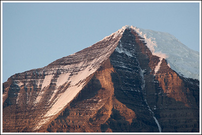
Mt. Robson's summit at sunset.

Mt. Robson's summit at sunset.

Day 2, Sunday, 09/13/09:

Up early–but not that early since the earliest we could get our permits at the Visitor Centre was 08:00. After permits for two for two nights ($20) and watching most of an informational video, we were off.

We had 13 miles to go that day in order to make camp at Berg Lake. By far Nicole’s longest backpack (and rivaling our longest dayhikes) and just as long as my final day out of Lower Ice Lake. Our bags were relatively heavy, but the elevation gain (~2800′) was spread over such a distance that it wasn’t too terrible. Except on our climb from Whitehorn Campground past the waterfalls until Emperor Campground…

Once at Berg Lake, we found a secluded site and relaxed.
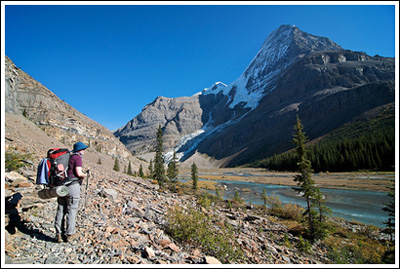
Nicole surveying upper Robson River as we approach Berg Lake.

Nicole surveying upper Robson River as we approach Berg Lake.

Day 3, Monday, 09/14/09:

I woke up early to take advantage of the clear skies, taking a dozen too many photos of Mt. Robson in the morning light. Our original plan was to hike to Snowbird Pass (~13 more miles) on this day. We toyed with the idea of doing a different, shorter loop, but decided on going up the trail to Snowbird Pass as far as we felt like it. Which ended up being about 8-9 miles, round trip. We didn’t make the pass, but the views of Robson and the Robson Glacier were outstanding.
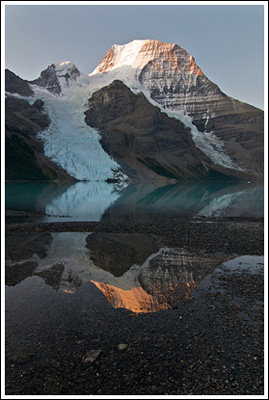
Sunrise lights up the top of Mt. Robson, reflected.
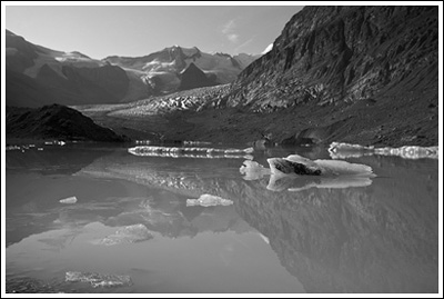
Sunrise lights up the top of Mt. Robson, reflected.

Robson Glacier lake, en route to Snowbird Pass.
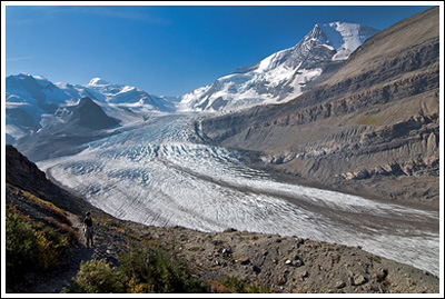
Robson Glacier lake, en route to Snowbird Pass.

Nicole, at bottom left, overlooks the massive Robson Glacier.

Nicole, at bottom left, overlooks the massive Robson Glacier.

Day 4, Tuesday, 09/15/09:

Not looking especially forward to 13 long miles out, but we made it, relishing every descending kilometer marker along the way. We’d thought about camping again after we made it out, but opted to check into the first hotel we found in Jasper. We did laundry, filled up our cooler with the hotel’s ice, and ate the best burgers ever.
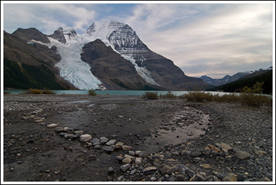
A path of stones leads to Berg Lake.
A path of stones leads to Berg Lake.

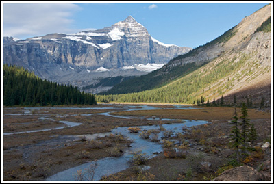
Following upper Robson River.
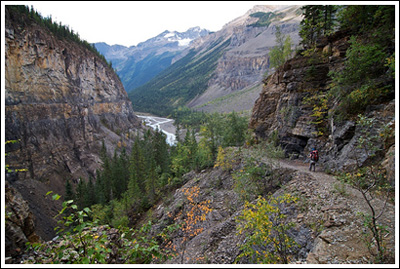
Following upper Robson River.

Nicole, at right, descends into the Valley of a Thousand Falls.

Nicole, at right, descends into the Valley of a Thousand Falls.

Day 5, Wednesday, 09/16/09:

Jasper to Lake Louise, via the Icefields Parkway, with photo stops. By far the most beautiful stretch of road I’ve driven.  We’d planned to hike Wilcox Pass, but it was closed due to blasting that also had us sitting still on the highway for an hour or more. Instead we hiked Parker Ridge, just south of the overflowing-with-Japanese-tourists Icefield Centre. A nice, easy hike, perhaps 4 miles.  Quite beautiful.  After the hike, we drove down to Lake Louise where we did some expensive car camping and I borrowed someone’s axe to chop our firewood while the bull elk bugled.
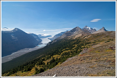
Atop Parker Ridge, looking down at the Saskatchewan Glacier.
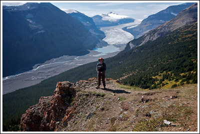
Atop Parker Ridge, looking down at the Saskatchewan Glacier.

Dork on cliff.
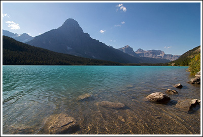
Dork on cliff.

Waterfowl Lake, on the side of the road.
Waterfowl Lake, on the side of the road.

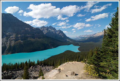
The beautiful Peyto Lake.

The beautiful Peyto Lake.

Day 6, Thursday, 09/17/09:

Woke up to raindrops on the tent, packed up the car before it turned to full-strength rain. Rest day it was! We drove to Banff and checked in early at our hotel, bummed around Banff. Expensive!

Day 7, Friday, 09/18/09:

Better weather, but after checking the Park Visitor Centre in town and verifying that Sentinel Pass was restricted to groups of 4 or more, and really not wanting to wait for/hike with someone, we decided to head back up to Lake Louise and climb up Fairview Mountain. Larches were in transition, and we reached the summit of 9000′, just below the cloud ceiling. Just over 6 miles round-trip. Then, back to Banff again via Highway 1A. Wildlife sightings in total: 1 bull elk, 3 deer, 1 porcupine, and, finally, a group of bighorn sheep.
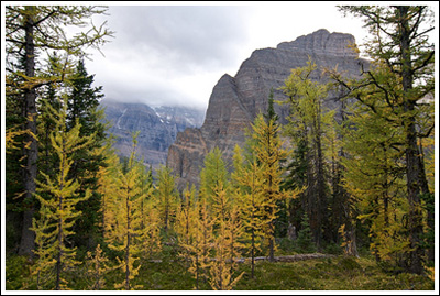
Larch, mountains, and clouds.
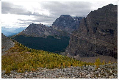
Larch, mountains, and clouds.

Above Saddleback.
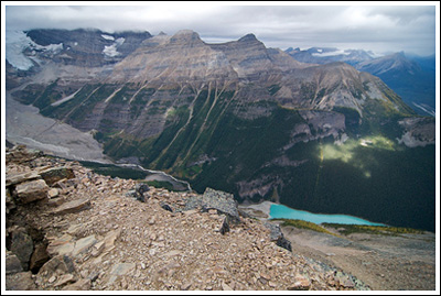
Above Saddleback.

Lake Louise as viewed from the summit of Fairview Mountain.
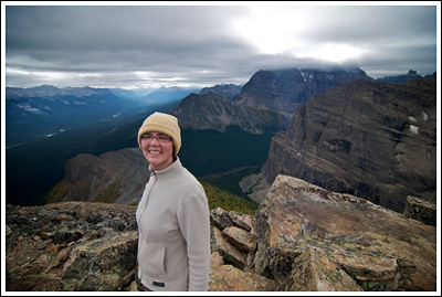
Lake Louise as viewed from the summit of Fairview Mountain.

Smile!
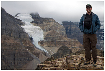
Smile!

Dork at 9000'.

Dork at 9000'.

Us.

Us.

Day 8, Saturday, 09/19/09:

An even longer drive back to Seattle via Yoho and Highway 1 instead of Highway 5/16. But we returned! We had a great time…

🙂 🙂 🙂

As always, plenty more photos at Flickr.

hikers_50