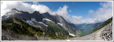
Klapatche Park, 07/24/10-07/25/10

When I first flipped through my copy of 50 Hikes in Mount Rainier National Park and saw Ira Spring’s photograph of Klapatche Park, the destination shot to the top of my to-hike list. And like most locations on my to-hike list, it just stayed there. I was reminded of it again last year, while watching The National Parks: America’s Best Idea, which briefly flashed another Ira Spring photograph of the same location, this one from many years earlier.

The problem is, Klapatche Park isn’t all that easy to get to. In the not-too-distant past, one could park their car within three miles of it, but the road washed out twenty-one years ago and left the western side of The Mountain more isolated than most of the rest.

After walking the more recently decommissioned Carbon River Road earlier this year, I decided that it was time to walk the Westside Road and visit the fabled Klapatche. The weekend’s weather would be perfect, and from what I’d read on the Mt. Rainier National Park website, snow levels seemed pretty favorable, too.

This trip would be solo.

Read more of this post

Cascade Pass, 08/23/09

After seeing friends’ photos from an overnight trip up Sahale Arm via Cascade Pass several years ago—even before we began hiking seriously—the trip has sat almost constantly atop our queue, waiting for the perfect window of time and weather to savor the experience.

This wouldn’t be that.

South and west from near Cascade Pass.

South and west from near Cascade Pass.

But it wasn’t half-bad, either.

After reading that the Cascade River Road would close September 1st and remain closed through much of October, I set aside the hope that this would be the year that we’d backpack up Sahale Arm and spend the night under starry skies and, instead, settled for a dayhike up to Cascade Pass, or perhaps a bit beyond.  If all I’d read was to be believed—i.e., that I’d run out of superlatives before reaching the pass—we’d be returning for that idealized evening on the Arm, anyway.

Knowing that the trail would be busy no matter what the time, and doing our best to get all of six hours of sleep after watching Inglourious Basterds the night before, we left West Seattle at 06:20.  After stopping in Marblemount in a thwarted attempt at a warm breakfast sandwich, we headed up the 23-mile Cascade River Road stuffing a quarter-pound of Costco muffin into each of our mouths.  Signs along the way warn that the road is primitive, but it’s actually an excellent road, with glimpses up and across the valley all along the way.  At 09:10, just less than three hours after leaving home, we pulled into a large, mostly-full parking lot.  I’d expected views at the parking lot, but I was impressed nevertheless by the dominating face of Johannesburg Mountain, even as seen through our cracked windshield.  Its upper reaches were shrouded in clouds.

hikers_50

Read more of this post

Big Quilcene to Marmot Pass, 06/06/09-06/07/09

I’d had my eye turned toward the Olympic Peninsula for several weeks. Our only hike on the other side of the Sound was a beach backpack, so we hadn’t really experienced the Olympic Mountains. And, after years of admiring them from afar, it was well past time to do something about it.

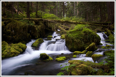
Falls in the Big Quilcene River.

Falls in the Big Quilcene River.

Last month, I’d decided that we’d hike the Upper Big Quilcene Trail #833.1 sometime soon. The Forest Service conditions report on 05/18/09 said the trailhead was open and that there was heavy snow around 5000′. With Marmot Pass another 1000′ above that, I decided to wait it out a bit. Several weeks passed, temperatures soared into the 90s—then retreated, and I forgot all about the knee pain from two weeks prior.

hikers_50 Read more of this post

Skyline Divide & Artist Point, 09/14/08-09/15/08

On this weekend, we decided to take it easy on ourselves–and I apologize if that attitude trespasses into the following trip report as well.  The plan was to head up to Mt. Baker on Sunday morning after listening to a bit of the Packers game, set up the tent somewhere, and then head out for an easy afternoon hike.  If we were feeling up to it, we’d do a little something on Monday morning, too.

We had a couple of bundles of firewood in the back of the Explorer and marshmallows and graham crackers in the cupboard.  We got ourselves some gasoline and two chocolate bars and headed north on I-5.  The only campground still open on SR-542 (Mt. Baker Highway) is Douglas Fir Campground, which is close to the trailhead we’d decided upon for our Sunday afternoon hike, Skyline Divide.

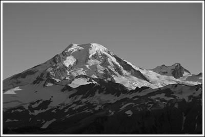
Mt. Baker from a knoll on the Skyline Divide trail.

Mt. Baker from a knoll on the Skyline Divide trail.

After checking in with the campground hosts (who said they’d had to turn away over 100 people on Saturday), setting up camp, and wasting a bit of time, we left for the trailhead.  I suppose I should say that–since I’d mentally deemed this hike too easy–I decided to complicate things by hitting the trail late in the afternoon so that we could catch the sunset, take some photographs, and then hike back down afterward, using our headlamps.  This would be our first time hiking in the dark.


Read more of this post

Nason Ridge, 07/20/08

A Monday commitment meant that we were left searching for a Sunday day hike, and this time Nicole made the call: Nason Ridge, right between US-2 and Lake Wenatchee. Actually, she’s supposed to be writing up this trip report, but it seems we’ll have to settle for some of her comments and impressions on this hike toward the end of this entry. Or look for a separate post from her on this topic. So: based on the trip reports, we expected a moderately difficult hike with no snow, decent views, an alpine lookout, and the high possibility of a mountain goat encounter. We weren’t disappointed.

Like many, we approached Nason Ridge via Round Mountain Trail #1529. Green Trails Map #145 (Wenatchee Lake) shows three ways up to Nason Ridge from US-2, but the route up Round Mountain has the advantage of having the highest starting elevation, at 3900’. The trailhead sits at the end of Road 6910, which is maybe 1/4 mile east of the Nason Creek Rest Area–we knew it was coming, and we still ended up missing it and turning around (look for a driveway with mailboxes and a small 6910 sign) . The road up to the trailhead is in suitable shape for most anyone–we took the Focus this time, and had no problem making it the ~4 miles to the trailhead.

We arrived at the trailhead at 09:55 to find five other cars and an outhouse, which we didn’t use because we’d stopped at the rest area just minutes before. We’d left West Seattle at 07:35, and run into minimal traffic, so that’s a little over two hours of driving time. We stepped out of the car to put on our boots and were immediately greeted by hungry mosquitoes. After applying sunscreen and bug dope, we set off. 10:10.

Read more of this post