Navaho Peak, 06/28/09

Somehow, Nicole and I had yet to truly reach a summit. It’s probably because we’d never picked a hike with the summit of a mountain as our destination. On Mt. Aix, we came close, only to be turned back by fear and thunderclouds. At Marmot Pass earlier this year, summiting Buckhorn Mtn. had been a thought until full backpacks and bum knees made us think otherwise. So reaching a summit was overdue, and Nicole in particular really wanted to accomplish that goal.

Mt. Stuart and The Enchantments Range from Navaho Peak.

Mt. Stuart and The Enchantments Range from Navaho Peak.

Cousin Bobby, who accompanied us on our hike to Goat Lake two weekends ago and didn’t break a sweat the entire time, wanted to go out again. We wanted to take him somewhere impressive, as we only have a few more free weekends until his internship ends. We also wanted to make him sweat.

Our friend David, who just returned from teaching English in Mexico for ~1.75 years and is staying with us at the moment, insisted that he had boundless energy and didn’t want to be left behind. He may have been exaggerating, and he might be regretting his decision at this very moment.

Our destination was chosen earlier in the week: Navaho Peak, in the Teanaway area. Like last week, we were unpleasantly surprised to find that Navaho Pass was declared WTA’s Hike of the Week. Undeterred by this obvious and repetitive display of telepathic plagiarism, we kept the plans in place as they were.

hikers_50

Read more of this post

Spider Meadow & Spider Gap, 09/07/08-09/08/08

When the weekend neared and Nicole brought home a recommendation of Spider Meadow, I immediately and enthusiastically agreed, having seen a number of trip reports earlier this summer about that very location.  A Sunday-night backpack it was.

Spider Meadow panorama.

Spider Meadow panorama.

Spider Meadow sits in the Phelps Creek basin some 25 miles north of Lake Wenatchee, within Glacier Peak Wilderness.  We planned on camping at the far end of the meadow, setting up a base camp, and–if energy permitted–exploring the area up to and including Spider Glacier and Spider Gap.  We took our time rolling out of bed on Sunday morning, and pulled out of West Seattle at 06:18.  Driving over to and along US-2 is approaching autopilot status, and before we knew it we were turning north towards Lake Wenatchee.  It’s just a few more miles before the turnoff up Chiwawa River Road, and then a long ~25 miles to the trailhead.  (We timed this portion of the drive on the way out, and it took ~45 minutes.)

On the way in, only a few miles down the road, we saw two backpackers on the side of the road, and picked up our first hitchhikers.  They were completing the Washington portion of the Pacific Crest Trail, which they’d had to abandon earlier due to injury.  We took them up to Trinity and the Buck Creek Pass trailhead, saving them a whole lot of road-walking.  (Though with the popularity of the trails in the area, they probably wouldn’t have had to wait long for another ride.)  After dropping them off, we turned around and drove up to our trailhead, which sits at the end of Road #6211.  It was 09:30 by that time, putting the drive time just over three hours (including a stop for gasoline and the hitchers).

Read more of this post

Mt Aix, 06/29/08-06/30/08

After a good week or so of searching guidebooks and websites for a high-altitude trail that maybe–just maybe–wasn’t completely covered in snow, I finally came across a few different references1 of the Mt Aix trail. Most were at least a year old, and therefore the conditions they described weren’t really applicable to this Spring’s stubborn snows and late melt; but there was a trip report from the end of May at NWHikers.net that was quite detailed. I decided that a month’s worth of southwestern exposure–including the three or four 80-90° days leading up to the day(s) of our hike–would’ve had a significant impact on the snow level, and that if we were lucky, we’d be able to make it prett’ near to the top. With the weather clear and hot, we’d also be able to fully appreciate the views that everyone assured would be there if it weren’t for those darn clouds. So: good weather, good views, and a hike with a difficulty rating I’d have to hide from Nicole. I stopped at REI and bought myself the Bumping Lake #271 Green Trails Map.

Since this weekend was our first wedding anniversary, we decided to elongate the trip by car-camping somewhere near Bumping Lake on Saturday night.

I have to take time out here to mention that this was our first time driving along WA-410, and it definitely will not be the last. It’s a great drive with amazing views. At one point, just after entering Mount Rainier National Park, I believe, there’s a great reveal of The Mountain, which led Nicole to exclaim: “Mother of God!” I don’t think she was very far off.

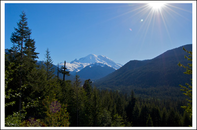
Mt Rainier from WA-410

Mt Rainier from WA-410.

Once off of Highway 410, there seemed to be dozens of side-of-the-road sites along Bumping River, but since it was a beautiful Saturday, almost all were occupied, and we didn’t even bother turning into the Forest Service pay-sites. Just before Bumping Lake there’s a no-fee Forest Service campground called Bumping River Crossing, and that’s where we pulled in for the evening. It had an outhouse and we brought two bottles of Cristalino that we weren’t going to carry up Mt Aix the next day, so it was more than adequate. The campground was populated, but still nearly half-empty, and we settled into a quiet site away from the river and collected twigs and branches for a small but necessary campfire–for the S’mores, of course.


Read more of this post