Railroad Grade via Park Butte Trail, 07/10/10

I threw everything in the back of the Forester Friday morning before work, planning to pick Nicole up after work and head to the mountains. Earlier in the week, we’d decided to camp Friday night and hike on Saturday morning. It’d been a while since we’d been up near Mt. Baker, and I figured we’d be able to camp last-minute along Baker Lake somewhere, so I started looking into options. The Mt. Baker-Snoqualmie National Forest website promisingly categorized the Park Butte Trail as “partially” open, going on to state that meadows were clear, snow was in the trees, and snowshoes were not necessary. Furthermore, I learned that there were hiker-only campsites at the trailhead. Sold.

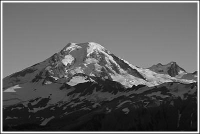
Bird in flight, Mt. Baker beyond, from Railroad Grade.

We made good time to the trailhead (I-5 -> WA-20 -> Baker Lake Highway -> FSR-13) and its large parking area. We set up our tent in one of the few single-night-only campsites set aside for hikers and drifted off to sleep early.

Read more of this post

Zion National Park, 05/28/10-05/31/10

A few months back, Nicole’s dad (a.k.a. Jim) said he wanted to meet up with us and his son (a.k.a. Miles) over Memorial Day weekend and do some backpacking or hiking. He suggested Yosemite, but snow levels and full campgrounds sent us searching for alternatives. I researched other areas in California, where Nicole’s dad and brother both live, but eventually put forth the option of Zion National Park in Utah—if they didn’t mind flying.

Zion sandstone in black and white.

Jim enthusiastically agreed and we quickly purchased airline tickets, booked a hotel room, and reserved a rental car. Prices and flight times conspired to send us into Salt Lake City (a 5-hour-from-Zion drive) instead of Las Vegas (a 3-hour-from-Zion drive). We’d leave Seattle Thursday night and return Monday evening…

Read more of this post

Canadian Rockies Grand Tour, September 2009

I’ve wanted to go to the Canadian Rockies since I first laid eyes on them. Via photography. With steady jobs and paid vacation time accruing, we circled a week on the calendar this Spring, set about planning and purchasing, and crossed our fingers.

I monitored the weather anxiously, but in the end, we were blessed with beautiful conditions for the majority of our trip. This won’t be my normal trip report, just basics and photos. We had an amazing time!

Day 1, Saturday, 09/12/09:

~9 hour drive from Seattle to Mt. Robson Provincial Park, via Kamloops (where we stopped to change money and buy groceries). I’d planned on camping that night at either Robson River Campground or Robson Meadows Campground. The river campground was closed for the season, so we set up camp at Robson Meadows after not-quite-visiting the Visitor Centre, which closed at 17:00, just before we arrived. The view of Mt. Robson from the highway was Wow!-inducing. I ran over again to the Visitor Centre to catch the sun set on Mt. Robson’s West Face.
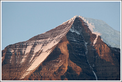
Mt. Robson's summit at sunset.

Mt. Robson's summit at sunset.

Day 2, Sunday, 09/13/09:

Up early–but not that early since the earliest we could get our permits at the Visitor Centre was 08:00. After permits for two for two nights ($20) and watching most of an informational video, we were off.

We had 13 miles to go that day in order to make camp at Berg Lake. By far Nicole’s longest backpack (and rivaling our longest dayhikes) and just as long as my final day out of Lower Ice Lake. Our bags were relatively heavy, but the elevation gain (~2800′) was spread over such a distance that it wasn’t too terrible. Except on our climb from Whitehorn Campground past the waterfalls until Emperor Campground…

Once at Berg Lake, we found a secluded site and relaxed.
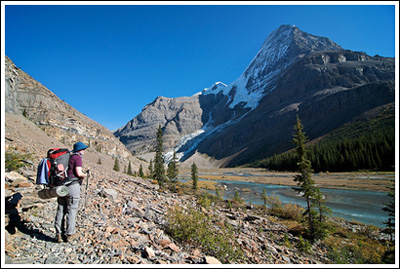
Nicole surveying upper Robson River as we approach Berg Lake.

Nicole surveying upper Robson River as we approach Berg Lake.

Day 3, Monday, 09/14/09:

I woke up early to take advantage of the clear skies, taking a dozen too many photos of Mt. Robson in the morning light. Our original plan was to hike to Snowbird Pass (~13 more miles) on this day. We toyed with the idea of doing a different, shorter loop, but decided on going up the trail to Snowbird Pass as far as we felt like it. Which ended up being about 8-9 miles, round trip. We didn’t make the pass, but the views of Robson and the Robson Glacier were outstanding.
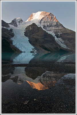
Sunrise lights up the top of Mt. Robson, reflected.
Sunrise lights up the top of Mt. Robson, reflected.

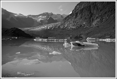
Robson Glacier lake, en route to Snowbird Pass.
Robson Glacier lake, en route to Snowbird Pass.

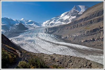
Nicole, at bottom left, overlooks the massive Robson Glacier.

Nicole, at bottom left, overlooks the massive Robson Glacier.

Day 4, Tuesday, 09/15/09:

Not looking especially forward to 13 long miles out, but we made it, relishing every descending kilometer marker along the way. We’d thought about camping again after we made it out, but opted to check into the first hotel we found in Jasper. We did laundry, filled up our cooler with the hotel’s ice, and ate the best burgers ever.
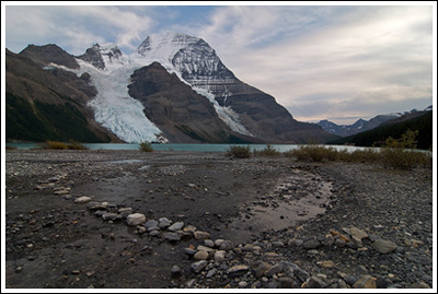
A path of stones leads to Berg Lake.
A path of stones leads to Berg Lake.

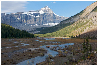
Following upper Robson River.
Following upper Robson River.

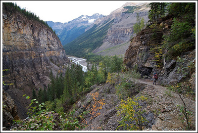
Nicole, at right, descends into the Valley of a Thousand Falls.

Nicole, at right, descends into the Valley of a Thousand Falls.

Day 5, Wednesday, 09/16/09:

Jasper to Lake Louise, via the Icefields Parkway, with photo stops. By far the most beautiful stretch of road I’ve driven.  We’d planned to hike Wilcox Pass, but it was closed due to blasting that also had us sitting still on the highway for an hour or more. Instead we hiked Parker Ridge, just south of the overflowing-with-Japanese-tourists Icefield Centre. A nice, easy hike, perhaps 4 miles.  Quite beautiful.  After the hike, we drove down to Lake Louise where we did some expensive car camping and I borrowed someone’s axe to chop our firewood while the bull elk bugled.
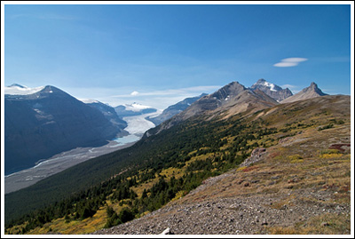
Atop Parker Ridge, looking down at the Saskatchewan Glacier.
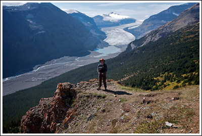
Atop Parker Ridge, looking down at the Saskatchewan Glacier.

Dork on cliff.
Dork on cliff.

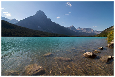
Waterfowl Lake, on the side of the road.
Waterfowl Lake, on the side of the road.

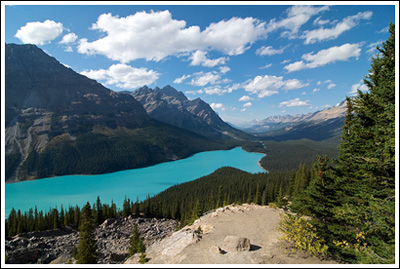
The beautiful Peyto Lake.

The beautiful Peyto Lake.

Day 6, Thursday, 09/17/09:

Woke up to raindrops on the tent, packed up the car before it turned to full-strength rain. Rest day it was! We drove to Banff and checked in early at our hotel, bummed around Banff. Expensive!

Day 7, Friday, 09/18/09:

Better weather, but after checking the Park Visitor Centre in town and verifying that Sentinel Pass was restricted to groups of 4 or more, and really not wanting to wait for/hike with someone, we decided to head back up to Lake Louise and climb up Fairview Mountain. Larches were in transition, and we reached the summit of 9000′, just below the cloud ceiling. Just over 6 miles round-trip. Then, back to Banff again via Highway 1A. Wildlife sightings in total: 1 bull elk, 3 deer, 1 porcupine, and, finally, a group of bighorn sheep.
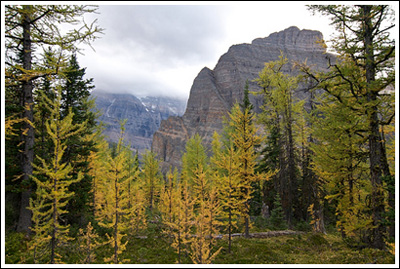
Larch, mountains, and clouds.
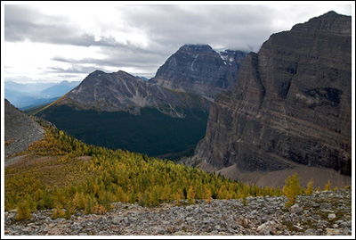
Larch, mountains, and clouds.

Above Saddleback.
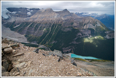
Above Saddleback.

Lake Louise as viewed from the summit of Fairview Mountain.
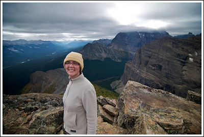
Lake Louise as viewed from the summit of Fairview Mountain.

Smile!
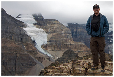
Smile!

Dork at 9000'.

Dork at 9000'.

Us.

Us.

Day 8, Saturday, 09/19/09:

An even longer drive back to Seattle via Yoho and Highway 1 instead of Highway 5/16. But we returned! We had a great time…

🙂 🙂 🙂

As always, plenty more photos at Flickr.

hikers_50

Blanca Lake, 07/26/09

We hadn’t yet combined car camping and day hiking this summer, and Cousin Bobby’s number of free weekends before his internship ends can be counted on one finger, so it was decided that we’d head out and camp somewhere Saturday and then hike on Sunday. Blanca Lake has been high on my to-do list for several years—basically since I picked up my first 100 Hikes… book. While researching the hike, I found out that the shorter approach to the trailhead via FS63 (Index-Galena Rd) was inaccessible due to a road closure, but the trailhead was still reachable via FS65 (AKA Beckler River Rd). I thought this might deter some people and keep the trail slightly less busy. So it was decided that we’d head up FS65 seeking a suitable and free camping site and hike up to Blanca Lake the next day.

North Fork Skykomish River near our campsite.

North Fork Skykomish River near our campsite.

Roommate David loaded up the cooler, the back of the Forester was full, and we stopped off in Mill Creek to pick up Cousin Bobby around 09:45 on Saturday morning. After an easy cruise on US-2 through Skykomish, we turned left on Beckler River Rd, which is also a pretty smooth ride, until it first turned to gravel and then intersected with FS63. Along the way there were several choice campsites along the water, but all were taken. Once we turned up FS63, the road became smaller and we were slightly worried we wouldn’t find a nice place to camp. We passed by the trailhead to Blanca lake and came a little closer to the North Fork Skykomish River, eventually finding a decent little grassy campsite with a fire pit and easy access to the water. By noon we were setting up our tents and settling in.

hikers_50

Read more of this post

Skyline Divide & Artist Point, 09/14/08-09/15/08

On this weekend, we decided to take it easy on ourselves–and I apologize if that attitude trespasses into the following trip report as well.  The plan was to head up to Mt. Baker on Sunday morning after listening to a bit of the Packers game, set up the tent somewhere, and then head out for an easy afternoon hike.  If we were feeling up to it, we’d do a little something on Monday morning, too.

We had a couple of bundles of firewood in the back of the Explorer and marshmallows and graham crackers in the cupboard.  We got ourselves some gasoline and two chocolate bars and headed north on I-5.  The only campground still open on SR-542 (Mt. Baker Highway) is Douglas Fir Campground, which is close to the trailhead we’d decided upon for our Sunday afternoon hike, Skyline Divide.

Mt. Baker from a knoll on the Skyline Divide trail.

Mt. Baker from a knoll on the Skyline Divide trail.

After checking in with the campground hosts (who said they’d had to turn away over 100 people on Saturday), setting up camp, and wasting a bit of time, we left for the trailhead.  I suppose I should say that–since I’d mentally deemed this hike too easy–I decided to complicate things by hitting the trail late in the afternoon so that we could catch the sunset, take some photographs, and then hike back down afterward, using our headlamps.  This would be our first time hiking in the dark.


Read more of this post