Navaho Peak, 06/28/09
June 29, 2009 5 Comments
Somehow, Nicole and I had yet to truly reach a summit. It’s probably because we’d never picked a hike with the summit of a mountain as our destination. On Mt. Aix, we came close, only to be turned back by fear and thunderclouds. At Marmot Pass earlier this year, summiting Buckhorn Mtn. had been a thought until full backpacks and bum knees made us think otherwise. So reaching a summit was overdue, and Nicole in particular really wanted to accomplish that goal.
Cousin Bobby, who accompanied us on our hike to Goat Lake two weekends ago and didn’t break a sweat the entire time, wanted to go out again. We wanted to take him somewhere impressive, as we only have a few more free weekends until his internship ends. We also wanted to make him sweat.
Our friend David, who just returned from teaching English in Mexico for ~1.75 years and is staying with us at the moment, insisted that he had boundless energy and didn’t want to be left behind. He may have been exaggerating, and he might be regretting his decision at this very moment.
Our destination was chosen earlier in the week: Navaho Peak, in the Teanaway area. Like last week, we were unpleasantly surprised to find that Navaho Pass was declared WTA’s Hike of the Week. Undeterred by this obvious and repetitive display of telepathic plagiarism, we kept the plans in place as they were.

So it was that our party of four left West Seattle at 06:00, an accomplishment in itself as far as I’m concerned. Now that I know I can get everyone out of bed at 05:30, it’s just another small step to get them up at 05:00, or even 04:30.
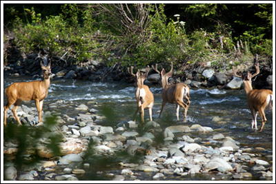
Getting to the Teanaway area is quite easy—it’s barely off I-90 just east of Cle Elum, where we stopped for Safeway deli sandwiches and David ran into the Cle Elum Bakery for some of his favorite cookies. Up WA-970 and the Teanaway River Road we went. Out in the river we saw three beautiful bucks—I jumped out of the car, opened the trunk, attached my telephoto and shot a few frames. It was a great sight.
With deer on the brain, we started back up the Teanaway River Road, expecting to see our trail’s number—#1359—on a sign near a right turn. After driving for ten or fifteen minutes, it became clear that we missed the turnoff, and had to turn around and backtrack. We were looking for Stafford Creek Road, but it is actually signed Road 9703, and while there is a trail number on a sign there, it wasn’t ours.
After that small setback, we pulled into the trailhead parking lot around 08:40 and were on the trail at 08:50.
The trail starts off along the river with several ups and downs, with more ups than downs. There is evidence that an older trail stayed closer to Stafford Creek, but it has been washed out and the trail re-routed above it. There are a couple forks of the older and younger trail. Branches are helpfully laid across the older trail—just stay right and go uphill. You’ll be going uphill the whole way anyway! Tiger Lilies are plentiful along this lower portion of the trail, and give way to Columbines shortly after. This portion of the hike isn’t terribly exciting, offering little views and a steady but gentle uphill grade. Thankfully, the sun still hadn’t risen above the ridge to the east, so we hiked in the shade.
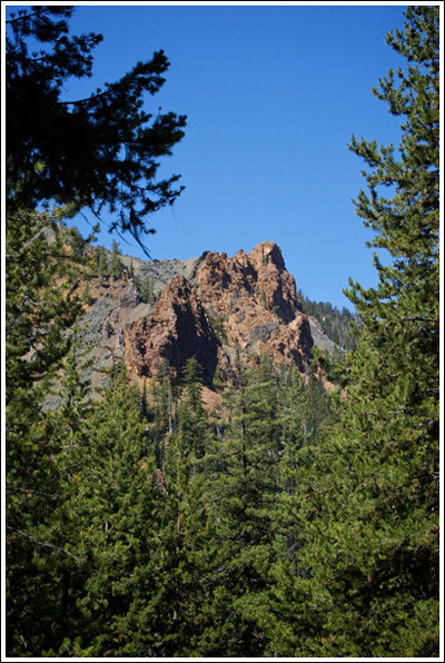
After a few miles, interesting red formations appear across the river, and the trail begins climbing a bit more earnestly. At 10:40 and 4.8 miles in, we reached the intersection with the Standup Creek Trail #1369. We all were doing quite well, though some expressed doubts about summiting what I’d erroneously pointed out as our destination earlier. Little did we know, we’d be going even higher. We continued on, our party separating by several minutes from time to time, with Bobby often well out in the lead and David bringing up the back. The red rocks across the river first were above us, then across from us, and then below us.
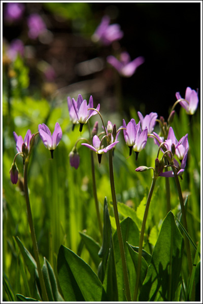
At 11:30 we came to a beautiful little meadow with purple flowers and a few steadfast glacier lilies. There were a few nice campsites, most occupied. At the meadow, the trail hugs the right side of the meadow—don’t walk straight across it!
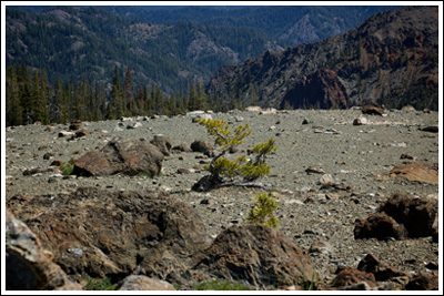
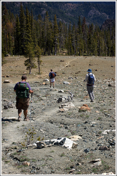
After the meadow, the trail crosses a picturesque stream lined with what I’m for now calling Purple Rocket Flowers and then sends you out across a barren moonscape on your final push to Navaho Pass. The rocks here are fascinating, and the scenery entirely different from what came before and what was to come after. At some point below, we’d left the safety of the shade and for the rest of the day we’d be hiking underneath a full sun. I wore long pants and a long-sleeved shirt and escaped with only minor sunburn on my right hand, others weren’t so protected and applied sunscreen, but too late.
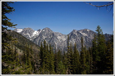
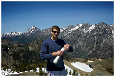
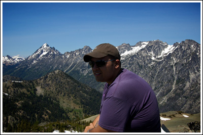
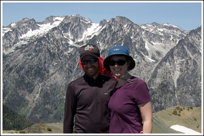
We took the last several steps and reached the pass at 11:55. The views across to the peaks of The Enchantments were excellent. We snapped a few photos (including some of a couple we’d been playing hiking hopscotch with on the way up) and sat down to eat our lunch. There was a very cool breeze that was refreshing momentarily, but we took shelter behind a few small trees to rest. We looked to the east of the pass at Navaho Peak, which still stood ~1200′ higher. For much of our ~thirty-minute rest, it appeared that we’d be leaving David behind and heading up to the summit ourselves. Then, after food and rest, he stood up to test his knee and pronounced himself fit to continue. We left for the summit at 12:30.
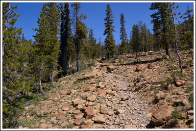
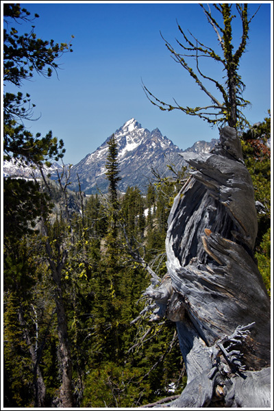
There’s a trail all the way to the top of Navaho Peak, easily followed. Like the rest of the trail, it’s quite dusty and dry, and small gravel and dust on a steep incline made for slow, slippery progress both up and down. Once again we each set our own pace, though Nicole did end up staying close to David and offering him support. While walking along the ridge, Mt. Adams comes into view off to the south, and then, Mt. Rainier in its glory. To the north, Mt. Stuart, which is mostly hidden at the pass, stands above The Enchantments. The climb was hot and slow. I stopped from time to time to look up toward Bobby—while I could still see him—and/or down to Nicole and David—when I could still see them. I put my bandanna underneath my hat and over my ears. For a while it felt like it was just me and the mountain. Near what I assumed to be the top, there were still two small patches of snow. I’d seen them from below and immediately placed a snowball under my hat. In just another minute or two I saw Bobby sitting atop the rocky summit. Even then I stopped a time or two to catch my breath and take in the view.
I reached the summit at 13:20. It felt amazing to be standing at the very top, with unobstructed views in every direction. I showed Bobby the summit register, which we pulled out and signed, an act each of us did for the first time. For fifteen minutes the two of us sat at the summit. Two young women were just below the summit, where they’d been when Bobby arrived. They left as Nicole and David arrived. I was very happy to see Nicole, I knew she really wanted to do it, knew she could do it, and was proud to see her standing on Navaho Peak and smiling. David surprised me beyond words—more cervezas and mole than mountains in middle Mexico, and here he was, up at the top of a mountain with us after just a week in the country! On our hardest hike to date!
We’d come ~7 miles and gained ~4100′ to be at the top of Navaho Peak. We stayed on the top, just the four of us, for the next ~thirty minutes. It was time well spent, and we knew we had a long way to down and out yet.
At 14:00, we left the summit. I gave David one of my trekking poles for the way out, which he accepted gladly after shunning trekking poles on the way up. The way out was long and slow. We stopped to filter a bit of water from below the pass. The group spread out wide as we continued down what felt like a very, very long final several miles. I knew we were getting close when the Tiger Lilies stood at the sides of the trail again.
Around 17:30, we all convened at the Forester, used the facilities, and gingerly set ourselves into our designated seats. After we’d set out from the pass to the summit, David had asked if he could drive home. “That depends on if you make it to the top,” I said. So David’s reward for summiting was driving us all home, including sitting in bumper-to-bumper traffic from Cle Elum to Keechelus Lake. And we really wanted to get home…
Which we did, at 20:20, some fourteen hours after leaving the house that morning.
We all pushed ourselves hard on this hike. It was worth it.
Stats: ~14 miles from trailhead to summit and back, with ~4100′ of elevation gain and loss. Our high point was the summit of Navaho Peak, 7223′. It took us 3:15 to get from the trailhead to the pass, and another 0:50 to make it to the summit. Return times were similar. Hike time: ~seven hours. This hike took us to a higher elevation than we’ve ever been, with more elevation gained than any other hike.
As always, a few more photos at Flickr.



Hey you guys! Sounds like a phenomenal day!! The pictures are beautiful as always. Way to go! What a wonderful achievement! 🙂
Thanks, Maggie.
Start training for your next visit!
way gorgeous, i must have looked right at navaho pk from little annapruna in the enchantments, but i can’t recall what navaho peak itself looks like….what gorgeous views though, looks well worth it!
I was pretty happy up there. Totally worth the work, and the work was part of what made making it to the top what it was.
Looking over at The Enchantments made me really want to get up there!
Pingback: The Year in Review, 2009 Edition « Don’t Look Down