Spider Meadow & Spider Gap, 09/07/08-09/08/08
September 10, 2008 15 Comments
When the weekend neared and Nicole brought home a recommendation of Spider Meadow, I immediately and enthusiastically agreed, having seen a number of trip reports earlier this summer about that very location. A Sunday-night backpack it was.
Spider Meadow sits in the Phelps Creek basin some 25 miles north of Lake Wenatchee, within Glacier Peak Wilderness. We planned on camping at the far end of the meadow, setting up a base camp, and–if energy permitted–exploring the area up to and including Spider Glacier and Spider Gap. We took our time rolling out of bed on Sunday morning, and pulled out of West Seattle at 06:18. Driving over to and along US-2 is approaching autopilot status, and before we knew it we were turning north towards Lake Wenatchee. It’s just a few more miles before the turnoff up Chiwawa River Road, and then a long ~25 miles to the trailhead. (We timed this portion of the drive on the way out, and it took ~45 minutes.)
On the way in, only a few miles down the road, we saw two backpackers on the side of the road, and picked up our first hitchhikers. They were completing the Washington portion of the Pacific Crest Trail, which they’d had to abandon earlier due to injury. We took them up to Trinity and the Buck Creek Pass trailhead, saving them a whole lot of road-walking. (Though with the popularity of the trails in the area, they probably wouldn’t have had to wait long for another ride.) After dropping them off, we turned around and drove up to our trailhead, which sits at the end of Road #6211. It was 09:30 by that time, putting the drive time just over three hours (including a stop for gasoline and the hitchers).

There were quite a few cars in the parking lot, and some scattered along the road, but a perusal of the registration sheet seemed to indicate that most people would either be camping beyond Spider Gap, or on their way out that very day. At 09:45, we headed past trailhead #1511: elevation: 3500’.
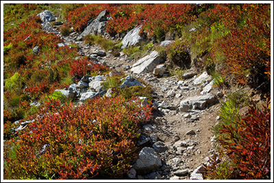
The trail starts off gently, undulating through forest interspersed with brushy bits, all the while with Phelps Creek off to your left, and below you. The trail is in excellent condition, which is a pleasant surprise considering the amount of horse traffic it seems to receive. That’s a veiled and polite way to say there’s a lot of horse poop on the trail. We didn’t see any of the offending horses, however. At 10:45, we entered Glacier Peak Wilderness, ~2.5 miles from the trailhead. This was exciting, since it was our first time in this particular Wilderness–an area I’m especially enamored with, even if it’s only on paper (and the internet) so far. At this point, and a few minutes further up the trail, there are several campsites off of the trail, which might be a good option for those who hit the trail late (very late) and are looking for somewhere to camp for an early, earnest start the following morning.
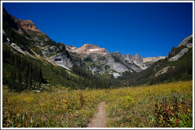
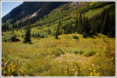
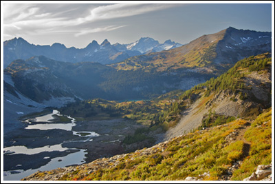
After a break for a snack, we continued on our way, covering another ~mile and crossing a rocky Leroy Creek at around 11:25. The trail in this area seems like it’s been rerouted in recent years, probably due to flood damage; and just after the [easy] creek crossing, it looks like an avalanche has hit recently as well. No matter, the trail is in excellent shape; and at 12:15, ~2.5 hours and ~5 miles into our hike, we came out of the trees (which had only provided obscured views west to Phelps Ridge) and were presented with a wonderful wide view of Spider Meadow. At the height of wildflower season, I’m sure it’s incredible, but I found the September shades of yellow and orange pretty pleasing as well. It’s here that my camera finally came out of its hiding place–permanently. We took a quick look at a posted map, which noted all of the approved campsites–and the meadow has quite a few, all of which seemed deserted by the time we got there. We spent fifteen minutes admiring the view, and while I was looking to the west, across the creek and over the horse-friendly campsites, I spotted movement in the rocks. Turned out to be a pretty large coyote–probably on the prowl for the many squeaking pika in the area. We were excited to see it, and after it disappeared into the trees at the south end of the meadow, we set off in the opposite direction.
By 13:00, we’d crossed the meadow, and came to the crossing of Phelps Creek. By this point we were hungry, and I was feeling the effects of ill-fated attempt to preempt blister formation with duct tape, so we stopped to eat and I removed my boots, socks, and duct tape. We ate, filtered some water, and spent a good amount of time enjoying the beautiful day–I forgot to mention that the weather forecast promised a 75° Sunday and Monday! Some ~40 minutes later we left lunch rock behind us and entered small section of forest with the first significant elevation gain of the day. In ~10 minutes, we reached the Spider Gap/Phelps basin junction (6.5 miles & 5300’).
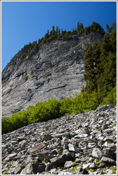
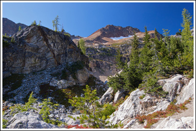
We’d planned on camping either somewhere near the junction, or up near Spider Glacier, and since we were feeling pretty well, and it was still early (13:50), we decided to push on and work our way up to what I assumed were spectacular campsites, if they were unoccupied. This meant that we had a lot of hard work ahead of us. I knew that we’d be gaining elevation, since Spider Gap sits at 7100’, but I didn’t realize just how much we’d be gaining just to reach our campsite. The map (Green Trails #113, Holden) goaded me on: a paltry 0.4 miles to go! After leaving the junction, the trail turns rocky, dry, and steep. And the sun was right above us, it being mid-afternoon by this point. Progress was slow; footing was poor. You know you’re in for it when you see this:
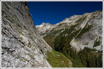
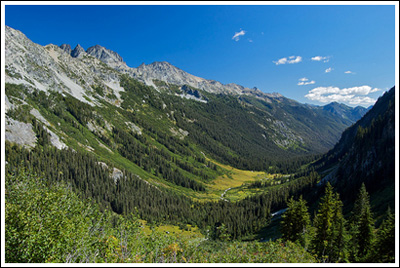
We worked our way up to the wall, stopping to listen to rattlesnakes that turned out to be grasshoppers. If there’s one good thing about this portion of the trail, it’s the views out over Spider Meadow, and the entire U-shaped Phelps valley below. The trail contours around the wall and keeps gaining through switchback after switchback, each one taking you higher and bringing more of the Entiat Mountains into view. It isn’t long before Mt. Maude and Seven Fingered Jack are visible to the southeast. By this time, I’m thinking, Yeah, 0.4 miles–as the crow flies!
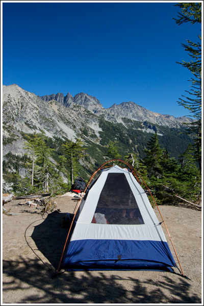
And just when all hope was nearly lost, the trail came around corner and revealed beautiful [empty] campsites, rushing water, and a sign that said “toilet”–all nestled on and around two large rock outcroppings below Red Mountain. This was the “larch knob” I’d read about! I yelled back to Nicole, “We did it!” It took us over an hour to make the climb up, but it was worth it. The sites were beautiful, and we had our pick of them. Of course, our pick ended up being the very first one we came to. At 15:00, we’d found our home for the evening.
Now, let me just run some numbers. The elevation at camp is ~6400’–a gain of 1100’ from the junction below. If, indeed, the last portion of the trail is 0.4 miles, it gains something that works out to 2750’/mile. That seems awfully steep. It’s not a friendly grade. But, as I said, don’t let it put you off! It’s over soon enough. Just soon enough.
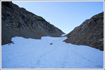
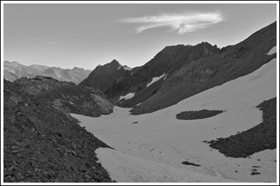
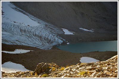
After a brief rest, and a short argument, I set off solo for Spider Gap, sans water bottle, at 17:05. Nicole was pretty beat, but I couldn’t be that close without making the climb up to the Gap to look down at Lyman Glacier, Lyman Lakes, and whatever else there was to see. That, and I wanted the experience of traveling up Spider Glacier, which many these days are diminutively calling Spider Snowfield or Spider “Glacier.” Hey, whatever: I wanted to climb up it, and I’m going to call it a glacier. The base of the glacier is just a minute or two away from the camps. I looked up, and it didn’t look too bad, so I started up the snow. It was a bit slippery, but it wasn’t steep, and there were some tracks to follow–I was happy, again, to finally have trekking poles.
All along the way, I could see that more than one person had chosen to glissade almost the entire way down, and so I decided that I, too, would attempt my first-ever seated glissade on my return. The picture above actually shows only the first 2/3 of the glacier. Once you reach that crest, you’re treated to a short level portion, and then the final and steepest bit that takes you right up to Spider Gap. Up the entire glacier, I was able to walk straight ahead, but at the top I chose to (that is, had to) follow some tracks that traversed it.
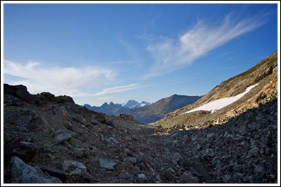
At 17:45, I made the Gap:
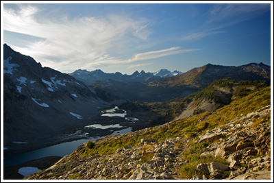
I continued on the quite visible trail to the north so that I could see more of Lyman Glacier and enjoy the views. Just up the trail I met a solo hiker setting up his tripod and settling in to spend the night and capture the sunset. Turns out he was professional–something about putting pictures on mugs and the like. We talked a little bit and I tried to have him confirm my guesses at distant peaks. No such luck, but I had a good idea of them anyway. I envied his ability to set up and await what would surely be a beautiful sunset on a beautiful location, but I had to get back to camp, apologize to Nicole, and help cook dinner. By 18:15, I was back at the top of Spider Gap, collapsing my trekking poles, and trying to figure out the best way to slide down a Spider Glacier on my butt. I figured collapsing my trekking poles would be a good thing to do. I wondered if I should take off my backpack and hold it in front of me. I wasn’t worried about stopping (“self-arrest”) at this point, since I’d naturally slow down and stop in the large flat area below the Gap. Up here the glissade trail was nearly a glissade half-tube, so I settled in and pushed off. In several exhilarating seconds I was at the bottom! My first glissade was a success. I kept my feet out of my way and managed to stay straight on the way down. I got up and walked to the next downhill section and tried again. Here, there wasn’t a nice half-tube to keep me on track–it was bumpy and meandering and the slope was gentle to the point that I’d peter out after only a short distance. I stayed seated, used my poles to push off again, with similar results. I kept at it, often spinning around and ending up with my head below my feet. Eventually I got tired of trying and stood up and worked my way down the glacier on my feet, half-sliding and half-jogging. I still made great time, and was back at camp at 18:35, just ~20 minutes from the point of my first half-assed (pun intended) glissade.
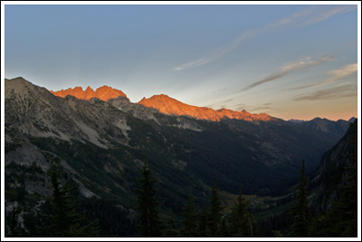
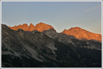
After dinner, the sun started to set behind Red Mountain and Seven Fingered Jack and Mt. Maude lit up across the meadow. It was difficult to capture, but beautiful to watch. I imagine the photographer above Lyman Lake was quite happy with the way the evening turned out.
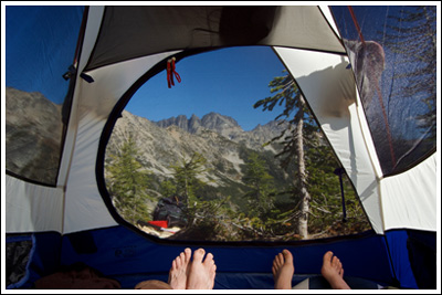
We stayed awake until the stars came out–the brightest thing in the southwest sky had us convinced it was a UFO, but it was just the mesh of the tent playing tricks with light. No doubt, it was a planet. Which one, I’ll have to investigate. The night was pleasurably cold; we slept well.

The next morning we overslept dawn, but I managed to open my eyes a few times and see some beautiful color in the direction of Seven Fingered Jack. Unfortunately, I couldn’t pull myself out of my sleeping bag. At 08:25, we left camp. Though we were dreading the descent, we made our way down the steep section and to the Spider Gap/Phelps Basin junction in ~25 minutes. Huh: I guess maybe it really is only 0.4 miles! Nicole’s knees held up like gangbusters down it, too. An hour after leaving camp, Spider Meadow disappeared behind us, and we had ~5 miles of morning forest walk ahead of us. As we neared the end, we slowed down considerably, since we were both pretty sore and Nicole’s knees reestablished themselves as forces of evil. Still, we reached the trailhead again at 11:35, just over three hours after breaking camp. By 15:00 we were back home, ready for food and Monday Night Football.
Great hike. Could be an easy but rewarding if one sticks to Spider Meadow. Great campsites all around. Great views. Great start or end to a trip of a few nights.
Distance: ~15+ miles round-trip to Spider Gap and back. The gap was the high point for Jeremy, at ~7100’; Nicole hung out at ~6400’. Our starting elevation was ~3500’, so we gained ~3600’ and ~2900’, respectively. It took us ~2:30 to reach Spider Meadow, ~0:30 to cross the meadow, and another ~1:20 to reach the campsites at Larch Knob. We took plenty of breaks, so our total time from trailhead to tent was ~5:15. Jeremy’s side-trip from tent to Spider Gap and back: ~1:20. The way out the following day: ~3:10.
As always, more photos at Flickr.


Very nice looking trip!! I’ve been wanting to head up there for some time now and your report makes me want to get up there very soon. Maybe my next days off will find me up there. Thanks for sharing.
Thanks, Bryan. It’s a great overnighter, and it seems easy enough to make it over the gap and down to Lyman Lakes, too. Looking forward to your pictures if and when you do make it up there.
As always, really nice photos and a great description of your trip. I have become a regular reader!
Thanks, Gregg! Great to hear that you’re enjoying the site. I’ve been checking out yours, too. Love the latest trip to Goat Rocks Wilderness. On the trip above, both the hitchhikers and the photographer said it was a wonderful place. Ya’ll are making me want to head down south!
wow — looks like an amazing place! love your photos!
seems like every hike we do lately has lots of horse-sh*t at the beginning…what’s up with that?
Sarah
Pingback: The Year in Review « Don’t Look Down
Fantastic site folks.
How many campsites are at the Larch Knob? Are they right off the trail, as in “can’t miss”?
Planning this trip in August.
(Wish you luck on the Enchantment permits, likewise here.)
adam
Thank you! Glad you’re finding the site useful.
I’d say there’s about 4 sites at Larch Knob. They’re pretty much can’t miss. You’ll know it when you get there. After the climb, you level off, there’s a side trail out to the knob, a trail uphill to a pit toilet, and the main trail continues onward, crosses a nice creek, and then hits the glacier.
On my way back down from the gap, I saw a tent set up on top of the large rocks west of where we camped, on the other side of the creek. So I know there’s at least a spot or two in that location, too. They’re not visible from below–we felt like there was no one within miles.
It’s a great hike–enjoy! And good luck with your permits!
Thanks Jeremy! Can’t wait till I hit this hike/camp along with Buck Creek Pass loop.
Did you get selected for the Enchantments? I may have spots to transfer to you for Labor Day weekend, if my group fails to commit. I’ll keep you informed as we near the date.
You’re welcome. There are some loops near Glacier Peak that I really want to do–hopefully I’ll get up there again this summer, maybe twice. I’m sure you’ll enjoy it!
Alas, we didn’t get Enchantment permits. I think our application was drawn in the 600s, and I was shooting for August or September, but was pretty flexible with start days. If you end up with extra permits, I would be honored if you transferred some to me. I can’t believe you got Labor Day weekend permits, at that!
The weather for this weekend looks good–hopefully I’ll get out for a day hike and have another reason to update the site.
Best,
Jeremy
Yeah, I was #111 of over 1300 applicants. I put Labor Day weekend as my first choice, but after consulting with friends, many say they already have plans. We shall see, and I’ll advise.
I’m going to try to get out for a day jaunt this weekend, just to shed the dust off the boots.
what an exceptional trip report! i am really grateful to you for writing it all out. Going to follow in your foosteps in 2 days and can’t wait!
Thanks a lot, Brad. Your comment prompted me to re-read this report. It is a great trip, I’m sure you’ll have a great time.
I’d love to get back to this area and do some of the semi-famous loops, too.
Is the trail dog friendly?
Hi Kady,
As far as I know, dogs are allowed on this trail, as it’s in National Forest and not within any Wilderness Area with special restrictions…
Have fun!